Resources Section
Technological Capabilities
Understand how Aerotas handles processing, modeling, and drafting when you need confidence that the workflow matches your project requirements.

Articles in this section
Back to ResourcesPhotogrammetry
Learn where imagery-based mapping fits best and why it remains central to many Aerotas workflows.
Image Compression
Understand how Aerotas balances imagery quality with file usability and transfer practicality.
GPS / GNSS Data Processing
See why positioning workflows are foundational to accurate drone mapping and final deliverable quality.
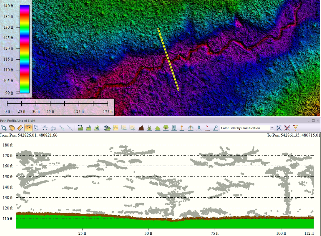
Lidar Data Processing
Review the strengths and complexity that make lidar valuable on the right projects.
Point Cloud Classification
Understand why separating ground, vegetation, and structures affects nearly everything downstream.
Surface Modeling
See how raw capture data becomes cleaner terrain and surface outputs for survey and engineering use.
Expert Drafting
Learn why human drafting judgment still matters in a modern drone production workflow.
Creating a Map
Connect the technical pipeline back to the finished deliverable you actually use.