Drone surveying is not right for every site, every project, or every business. That said, it is useful on far more projects than many people assume. The practical test is not whether the drone can get in the air. It is whether the drone can collect the data you need reliably, legally, and efficiently.
Good fits for drone surveying
In general, drones are most effective on projects that are:
- Open enough for the aircraft to see the ground or the features that matter
- Large enough that walking the whole site would consume significant field time
- Outside dense urban conditions or highly constrained airspace, or at least manageable from an authorization standpoint
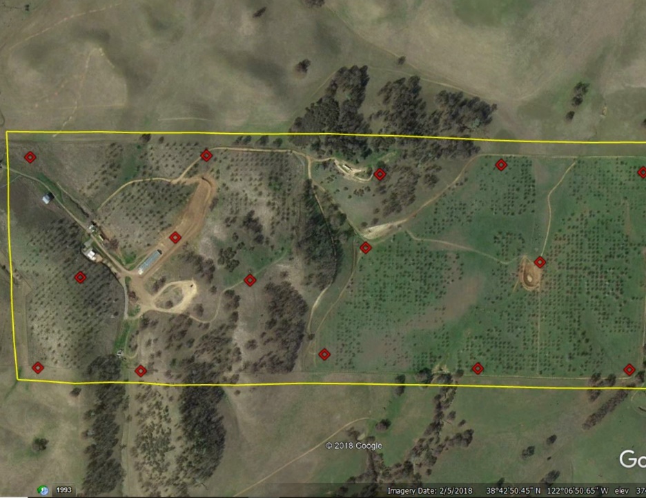
- Looking for topo, planimetric context, existing-condition documentation, or a complete site record
Aerotas has supported drone workflows for topographic mapping, ALTA support, construction, planning, subdivision, and many other project types. On those jobs, one of the biggest benefits is that the drone captures a broad snapshot of the site so you can revisit the data later without returning to the field for every missed visible feature.
When drones are the wrong tool
There are also clear cases where drones are not the best primary tool:
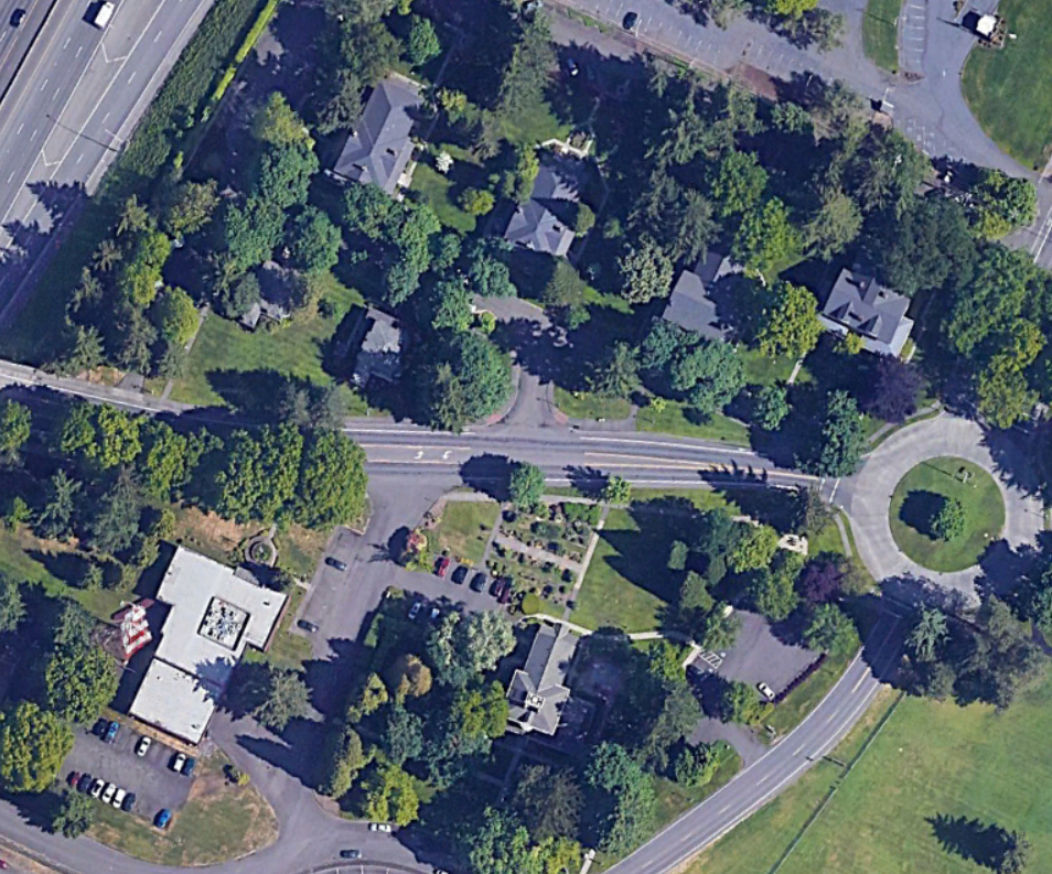
- Heavy vegetation with image-only workflows. Photogrammetry can only map what the camera can see. If the ground is fully hidden, image drones are a poor fit unless lidar is used.
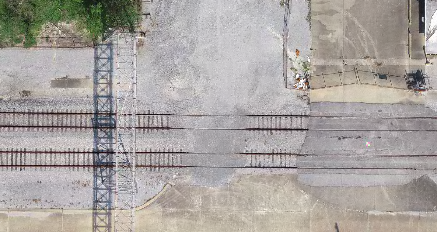
- Projects dominated by obscured or underground features. If the critical information is below canopy, below grade, or hidden under structures, the drone cannot solve that problem by itself.
- Very high-precision isolated features. If the main deliverable hinges on points that require tighter tolerances than the aerial workflow can reliably support, conventional methods should lead.
- Legally constrained fieldwork. Property boundaries and other jurisdiction-specific requirements often still require boots on the ground.
The site-fit questions worth asking first
Before flying, ask a few simple questions:
- What deliverable needs to be created at the end?
- What parts of the site need to be measured conventionally anyway?
- Can the drone actually see the features or surface that matter?
- Is the site in controlled airspace or another restricted environment?
- Would lidar change the answer on a vegetated site?
This is why Aerotas often describes the original question "Is this a good site to use my drone on?" as slightly misleading. A better question is: What data do I need to collect on this site, and is the drone the right tool for that part of the work?
Client-facing rule of thumb: if the site is open, the airspace is manageable, and the deliverable depends on broad existing-conditions capture, drone surveying is usually worth evaluating early.
Legal and practical limits still matter
Even when a site is physically flyable, the workflow has to be practical. Controlled airspace may require authorization. Busy public settings may require tighter scheduling and more operational discretion. Some sites are legally accessible to drones, but operationally inefficient because the paperwork, timing constraints, or risk profile outweigh the benefit.
That does not mean those sites are impossible. It means the value case should be weighed honestly before treating the drone as the default answer.
The best reason to use a drone
One of the strongest reasons to use drone surveying is the ability to collect a complete visual record of the site. If the project benefits from being able to revisit the condition of the site later, add visible detail after the fact, or support drafting from a much richer record, then the drone often earns its place quickly.
When the site is open enough, the airspace is manageable, and the required accuracy matches the workflow, drone surveying can be one of the most efficient tools available. When those conditions are not present, it is better to know that up front and choose another method.