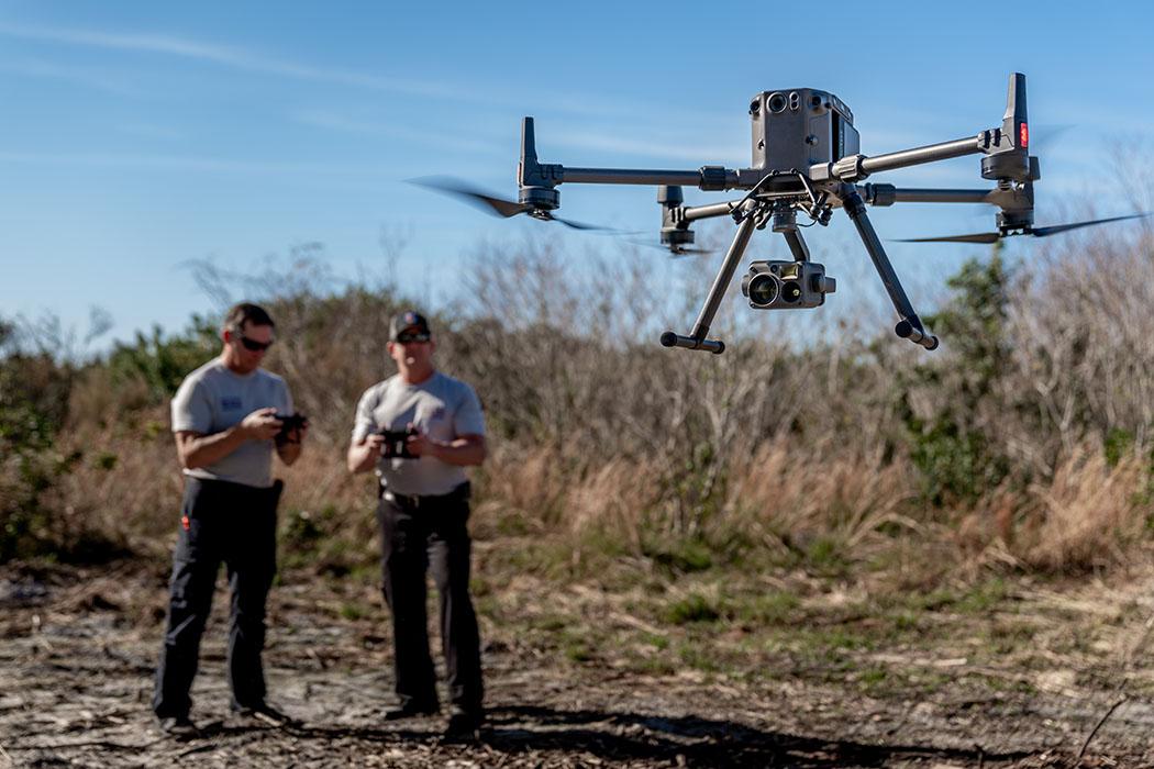
Drone surveying is not just flying a site and handing over pictures. At its core, drone surveying is the process of turning drone-collected data into usable survey and engineering deliverables. The aircraft is simply the collection tool at the front of a much larger workflow.
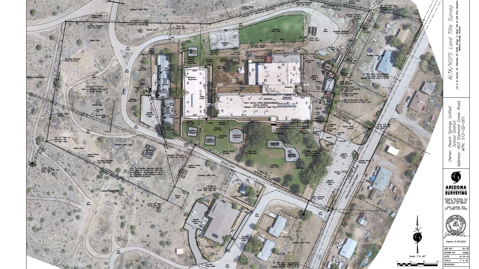
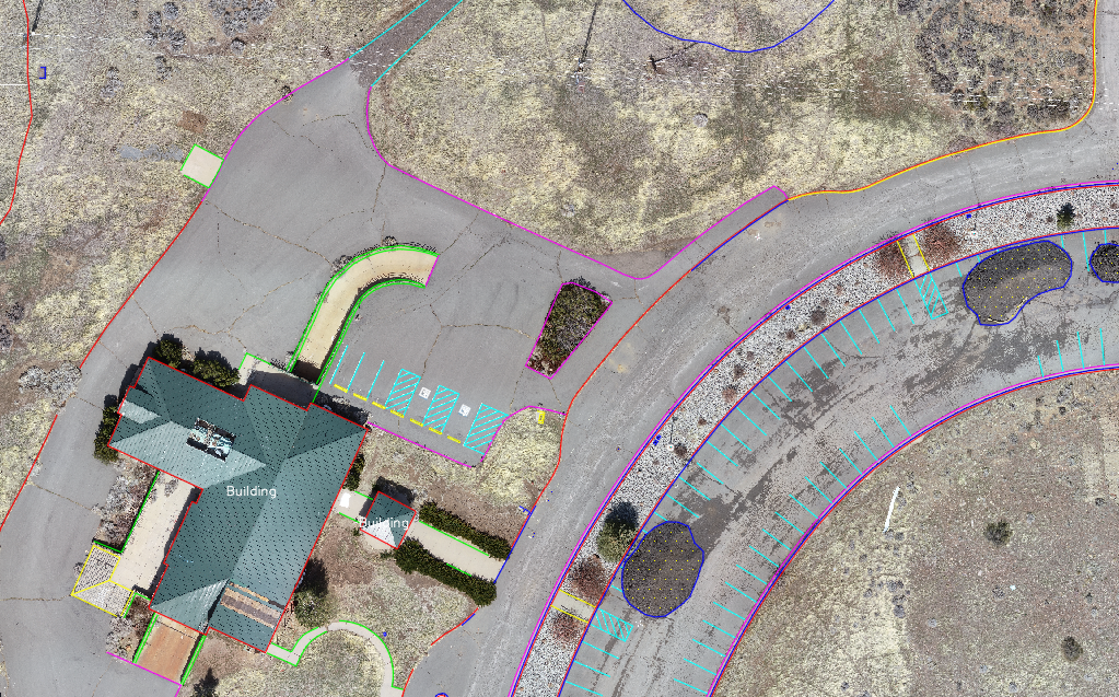
Modern drone surveys start with a planned mission and a clear deliverable target. The aircraft captures aerial imagery and, on some systems, lidar data. That capture is tied to positioning information from GPS or GNSS and then processed into outputs such as orthophotos, point clouds, surfaces, contours, and CAD-ready drafting.
The important distinction: the drone is only the front end of the workflow. Survey-grade results come from the combination of flight planning, ground survey control, processing, quality assurance, and professional judgment.
What data does a drone actually collect?
Most survey drones collect one or both of the following:
- Imagery for photogrammetry. High-resolution cameras capture overlapping photos that can be processed into a 3D model and orthorectified imagery.
- Lidar data. Some systems emit laser pulses that can measure surfaces and, on the right sites, help map through vegetation more effectively than imagery alone.
That aerial data is typically paired with ground control points, checkpoints, or RTK/PPK GNSS workflows so the final map ties correctly to the project coordinate system and can be tested for accuracy.
How photogrammetry, lidar, and GNSS work together
Photogrammetry uses the overlap between many images to reconstruct the geometry of a site. It is cost-effective, widely used, and excellent on open sites with good visibility from above.
Lidar measures distance directly and is often the better fit on vegetated sites, corridors, and projects where image-only methods cannot see enough of the ground surface.
GPS / GNSS provides the positioning backbone. Whether the workflow relies on conventional ground control, RTK, PPK, or a hybrid approach, good positioning is one of the main factors that determines whether the final outputs are just visually useful or truly usable for survey and engineering work.
What does drone surveying produce?
When the workflow is set up properly, drone surveying can support a range of outputs:
- Orthophotos for site reference and drafting context
- Point clouds and 3D surface models
- Contours, breaklines, and CAD linework
- Planimetric drafting and deliverable-ready mapping
- A full visual record of the site as it existed on the day of the survey
The final survey should still look like a professional survey. The drone simply makes it possible to collect certain categories of data faster and more completely than walking every part of the site by hand.
Why surveyors use drones
Aerotas has long framed the value of drone surveying around practical outcomes: better records, less field time, and deliverables that fit existing workflows. On the right projects, the drone can reduce the time spent walking a site, create a more complete record of existing conditions, and help teams focus their highest-accuracy field effort where it matters most.
That is why drone surveying is best understood as both an art and a science. The science is in the positioning, processing, and measurement. The art is in choosing the right workflow for the site, the required accuracy, and the deliverable that has to be produced at the end.