Full Linework is the flagship Aerotas product because it is the easiest way for most surveyors and engineers to get from drone data to a deliverable-ready CAD base map without building that map in-house.
You fly the site. Aerotas handles the processing and drafting. Your team gets a broad, usable package instead of a pile of intermediate files that still need days of cleanup.
Best Fit
Choose Full Linework when you want the map, not just the ingredients.
- You need both terrain and visible feature drafting.
- You want to reduce office backlog, not move it around.
- You need a dependable default scope for topographic, existing-conditions, and as-built work.
Why customers buy this product
Most internal teams do not have a raw-data problem. They have a production problem. Orthophotos, point clouds, and surfaces are useful, but they are not the final map. Full Linework exists to remove the expensive step between “we flew it” and “we can actually draft from this.”
That is why this is usually the right starting point for new Aerotas customers. It gives you the broadest practical deliverable with the least internal rework.
What you get
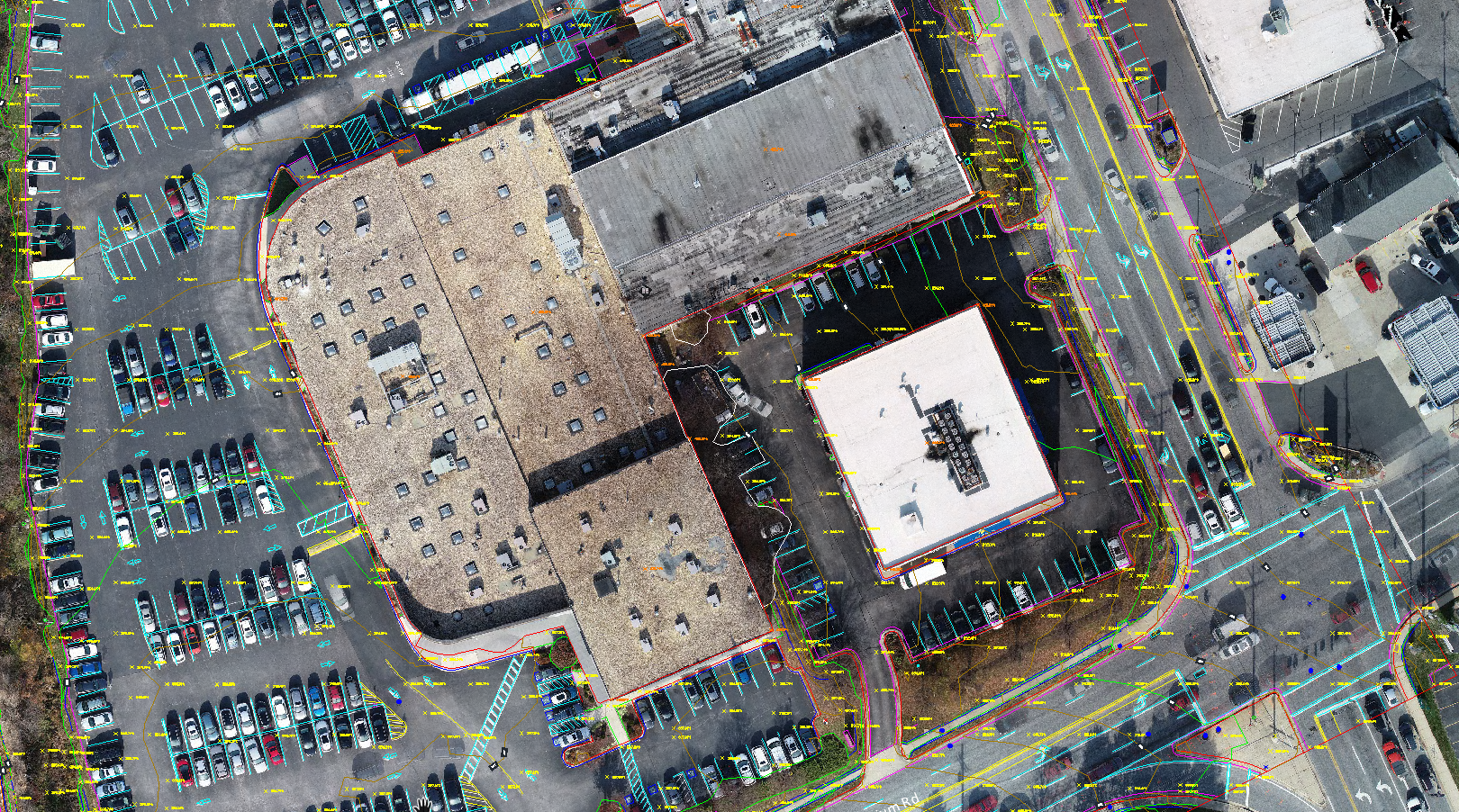
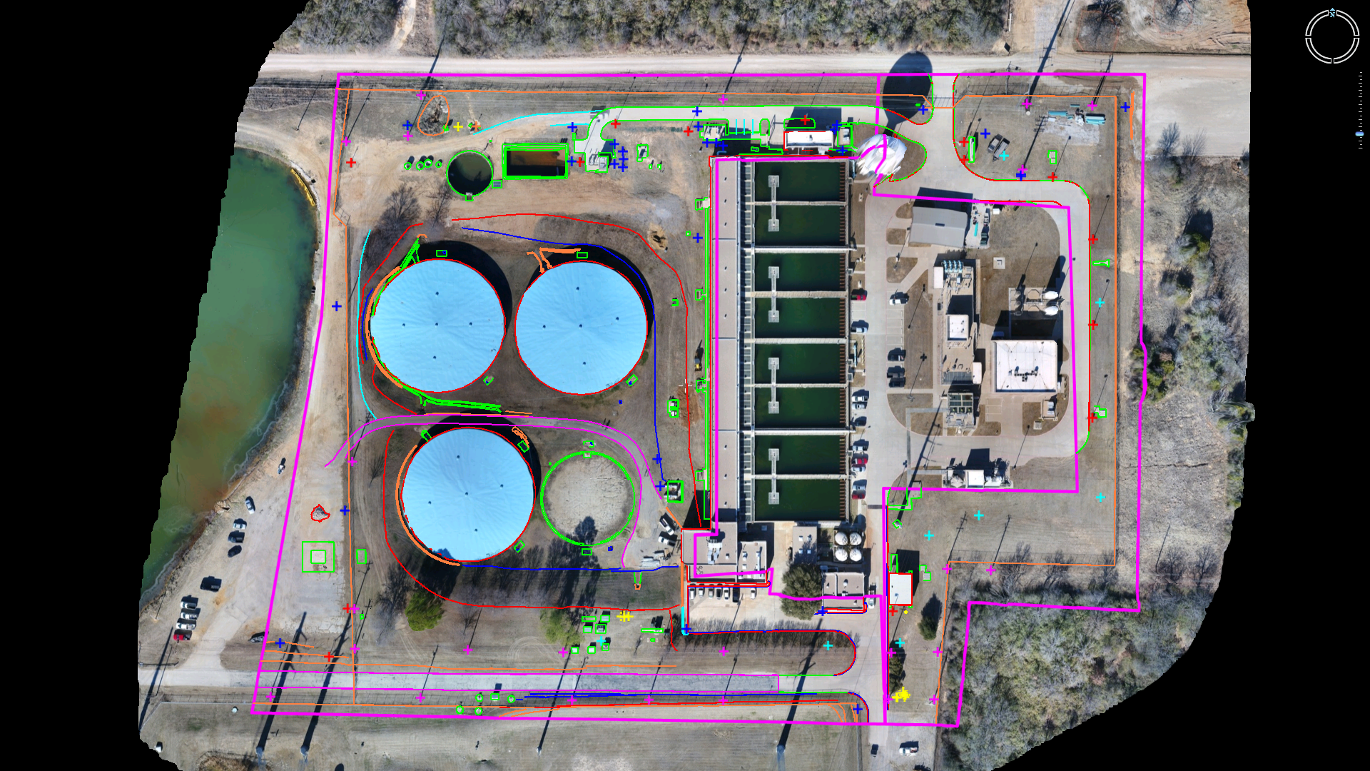
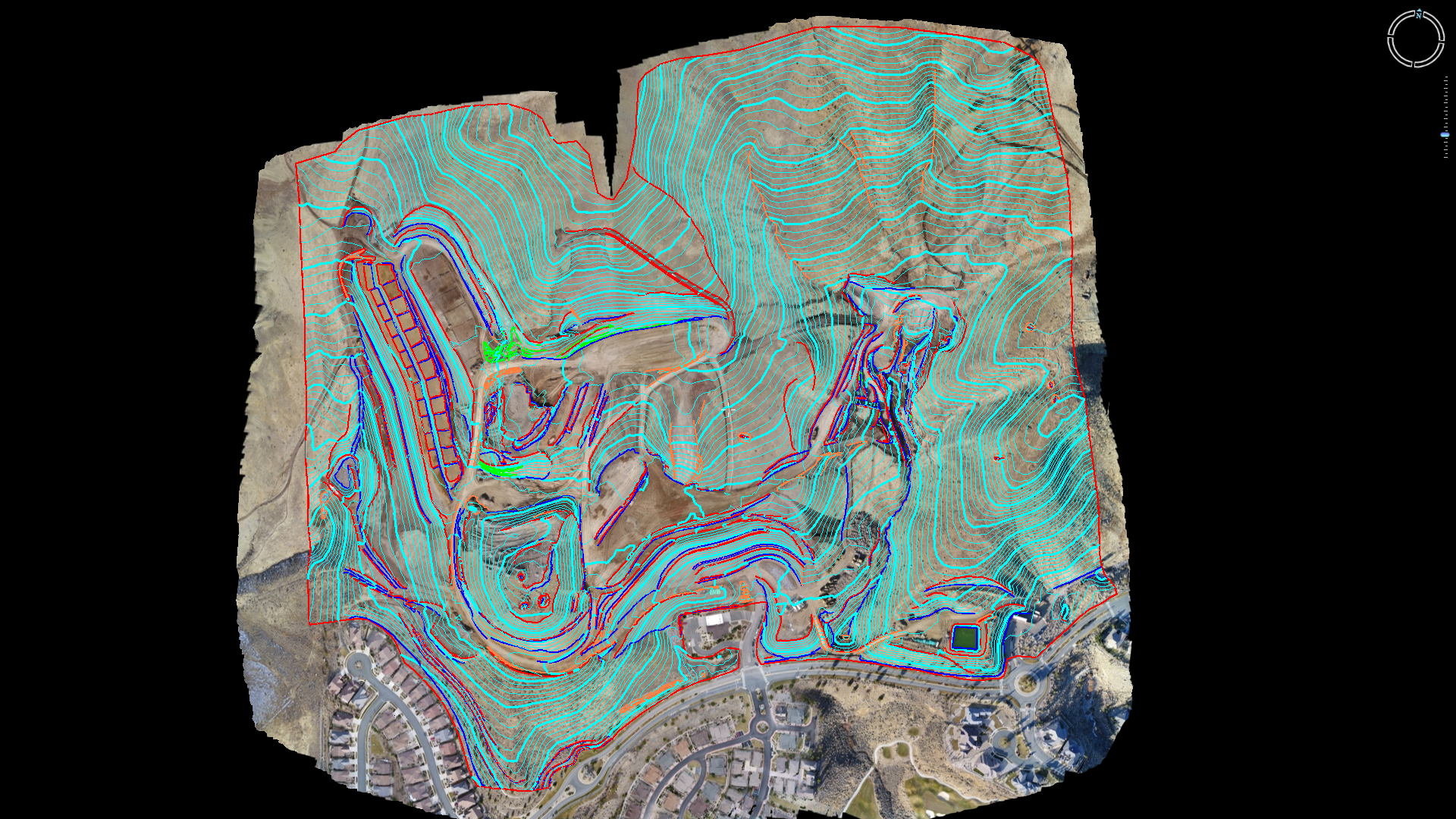
Aerotas has long described Full Linework as photogrammetry plus clean topo surface or TIN plus planimetrics. In practical terms, that means the package includes:
- Orthophoto and photogrammetry outputs
- Clean topographic data with spot elevations, breaklines, contours, and a TIN surface
- Drafted visible features such as striping, utility access panels, pavement edges, water features, building outlines, and similar site detail
- A single DWG-oriented package designed for survey and engineering workflows
Industrial as-built mapping
When you need topo plus visible site detail, Full Linework removes the drafting burden that would otherwise sit on your internal team.
Large construction and existing conditions
This is the default Aerotas fit when the site is large enough and visible enough to justify a complete drone-based map package.
When Full Linework is the right choice
- Topographic surveys where you need both terrain and visible site features
- Engineering base mapping and design support
- As-built and existing-conditions work
- Projects where internal staff should not spend days drafting from imagery
- Jobs where a dependable, broad-scope deliverable is worth more than the lowest possible initial scope
When not to buy more than you need
If the project only needs a clean terrain model, Clean Topo Surface may be enough. If you truly want processed imagery only and will draft internally, Photogrammetry Only may fit.
For most customers, though, Full Linework is the safest buying decision because it gets you to the usable map fastest.
Next Step
If you are not sure which product to choose, Full Linework is usually the right place to start.
It is the most broadly useful Aerotas deliverable and the one most likely to save your team real production time immediately.