Resources Section
Aerotas Products
Compare Aerotas deliverables, choose the right scope for your project, and move toward a quote with less guesswork.

Articles in this section
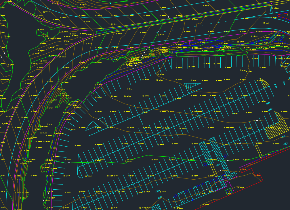
Back to ResourcesFull Linework
Start here if you need a deliverable-ready CAD base map and want the most common Aerotas scope for survey and engineering projects.
Power Line Survey
Start here when your project involves transmission or distribution mapping and the output needs to fit corridor design workflows.
ALTA / NSPS Standards
Read this if you are supporting ALTA work and need to understand where Aerotas fits within that aerial workflow.
Clean Topo Surface
Choose this when you mainly need a reliable terrain model without the broader drafting scope of full linework.
Photogrammetry Only
Use this option when you want processed imagery outputs but plan to keep drafting and downstream interpretation in-house.
Aerotas Atlas
Go here if you need Aerotas to handle both field collection and processing for a more complete end-to-end mapping workflow.