Drone Data Processing for Land Surveyors
Turn drone capture into survey-grade CAD maps faster. Aerotas helps surveying and engineering teams move from aerial data to accurate, usable deliverables without adding in-house processing burden.
Products
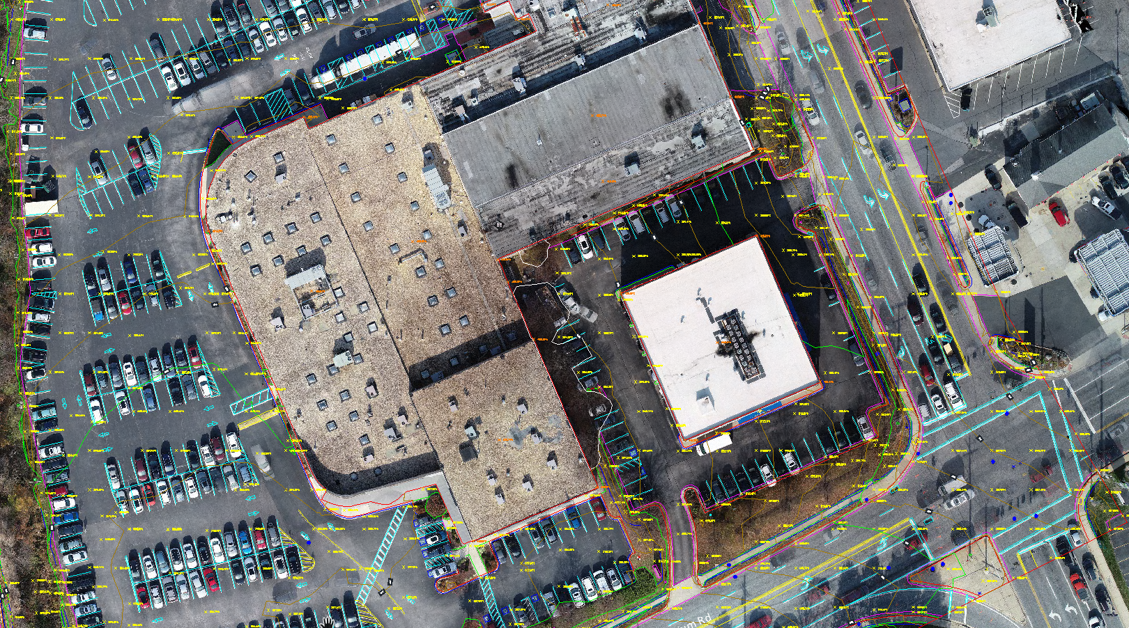
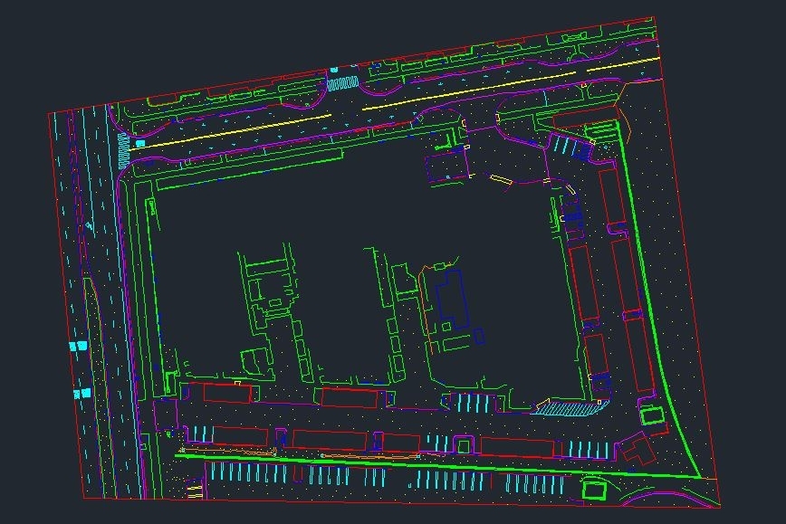
Full Linework
Survey-grade CAD linework prepared from drone data for practical surveying and engineering workflows.
Learn More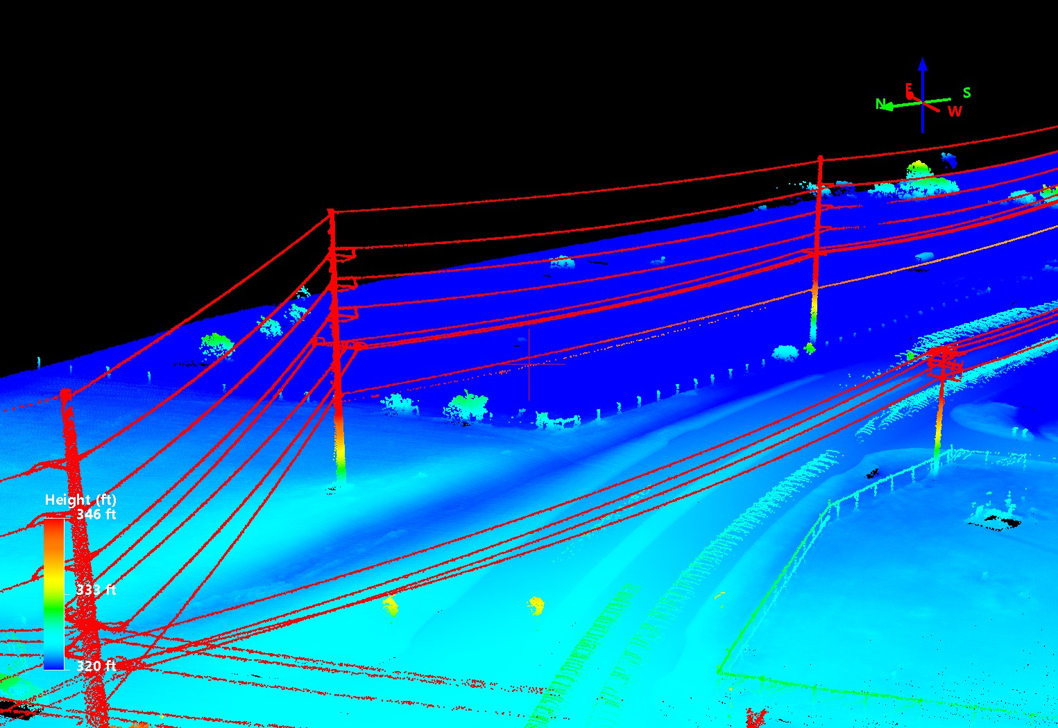
Power Line Survey
Detailed mapping deliverables tailored for utility corridor, conductor, pole, and infrastructure survey needs.
Learn More
ALTA / NSPS Standards
Deliverable support for projects requiring drafting and mapping aligned with ALTA / NSPS standards.
Learn More
Clean Topo Surface
Processed terrain models and clean topographic surfaces for engineering, planning, and design use.
Learn More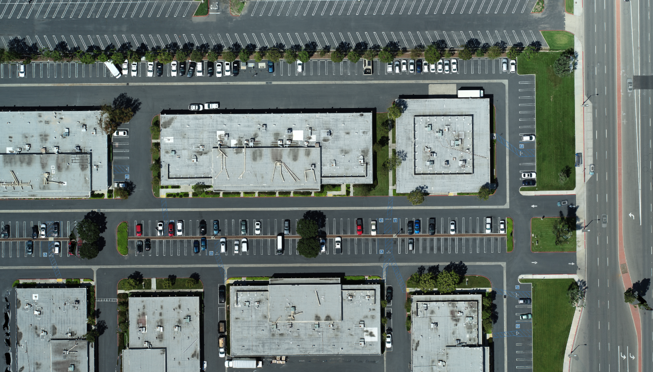
Photogrammetry Only
Professional orthomosaics, point clouds, and surface outputs generated from aerial imagery.
Learn MoreWorking with Aerotas
Every project is quoted and delivered on a per-project basis. No long-term contracts, subscriptions, or credits. Just high-quality maps when you need them.
1. Request a Free Quote
- Request a free quote in our web app for any project.
- Quotes are usually turned around same-day.
- Quotes are always free.
2. Choose your Deliverable
- We provide multiple options based on your needs.
- Whether you need rushed turnaround or additional detail, we help you choose the right scope without overcharging for unnecessary extras.
3. Upload your Data
- Once you fly the site, send us the data and we will get started.
Pricing
The best way to understand our pricing is to request a free quote. Just upload a .kml or .kmz file to get started.
Our Process
Aerotas applies a professional workflow to every project, combining software, processing skill, drafting expertise, and quality control to produce dependable mapping deliverables.
Protecting Land Surveyors
Aerotas is not a licensed land surveying firm and does not offer professional land surveying services where licensure is required. Land surveying is an important and highly regulated profession. Final certification, interpretation, and professional judgment remain the responsibility of the licensed surveyor or engineer of record, as applicable. Aerotas provides high-quality data processing, drafting support, and mapping deliverables that help licensed professionals work more efficiently.
Frequently Asked Questions
What data do I send you?
Typically, raw drone imagery plus any related field data needed for the project, such as ground control, checkpoints, flight logs, or project notes.
How accurate is the data?
Accuracy depends on equipment, control, flight execution, site conditions, and requested deliverables. We help match the workflow to the project requirement.
What software do you use?
We use a range of professional tools for photogrammetry, lidar processing, GNSS workflows, drafting, and CAD mapping depending on the project scope.
What coordinate systems do you use?
We work in the coordinate system required for the project whenever possible, based on the information and control provided.
Is your data drafted by AI or by humans?
Our deliverables are built through professional workflows with human oversight and drafting review. Automation may be used where appropriate, but outputs are not simply handed off to unreviewed AI generation.
Demo Deliverables
Review example outputs and sample files to see the quality and structure of Aerotas deliverables before starting a project.