December 2025 DJI "Ban" Update
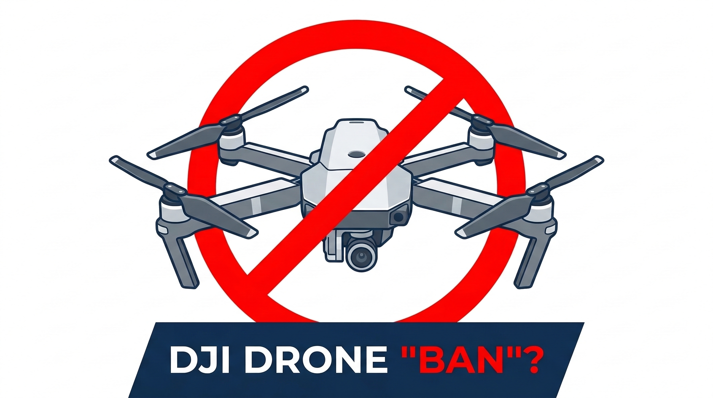
Today, the FCC announced the result of what many people have been calling a potential DJI ban. The details have now been released, and the restrictions...
Read postAerotas Blog
Insights on regulations, hardware strategy, field operations, and the realities of using drones in professional surveying workflows.
Today, the FCC announced the result of what many people have been calling a potential DJI ban. The details have now been released, and the restrictions...
Read postIn one hour, we’ll show you exactly what changed in 2025 that will impact your revenue, liability, and competitiveness in 2026, and what top firms are...
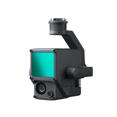
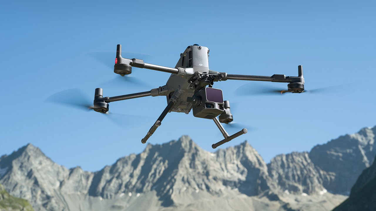
Read postOn November 4th, 2025, DJI announced the latest upgrade in their aerial lidar sensors, the Zenmuse L3. But will it be a good sensor for surveyors? And...
Read postHere is the uncomfortable truth: no true peer competitor exists today. Dollar for dollar, DJI remains the best overall platform for most commercial...
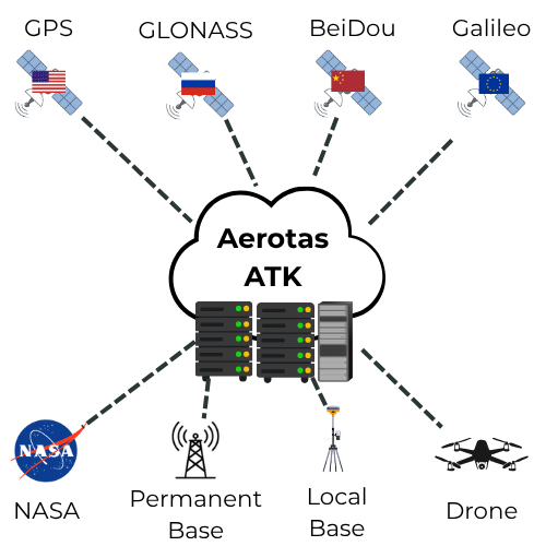
Read postA modern, resilient approach to drone GNSS post‑processing for land surveyors and engineering teams.
Read postThank you to all who attended sessions 1 and 2 of our three-part educational webinar series: Mastering Aerial LiDAR in Land Surveying.
Read postThank you to all who attended Session 1 of our three-part educational webinar series: Mastering Aerial LiDAR in Land Surveying. In case you missed it,...
Read postThis three-part series equips civil engineers and land surveyors with actionable insights to harness cutting-edge LiDAR technology, optimize business...
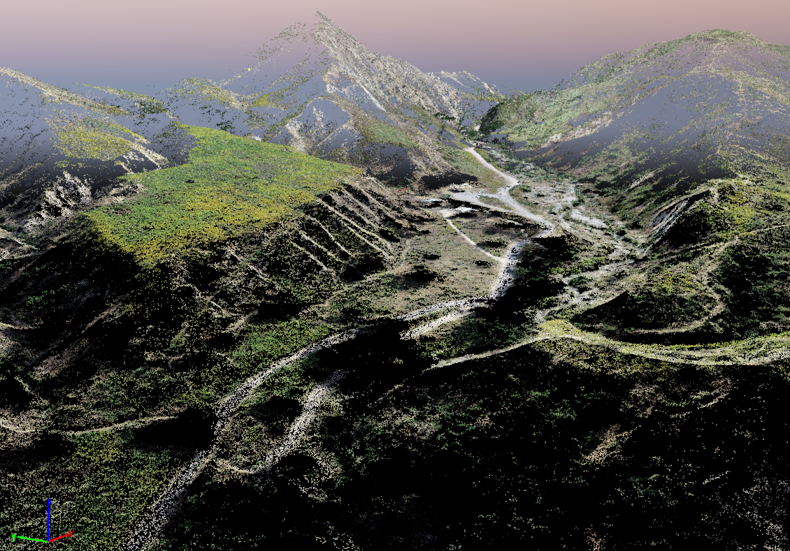
Read postLidar technology for Land Surveying has been around for decades, but technological advancements have now made lidar more accurate, reliable, and...
Read postLive Webinar: December 18, 2024 | 1:00 PM ESTAt Aerotas, we process data from almost every type of drone there is. We have processed tens of thousands...
Read postThere are many ways to set up your GPS for surveying, and working with RTK or PPK-capable drones increases this complexity. What is the right setup and...
Read postLive Webinar: August 29, 2024 | 1:00 PM EDTJoin Aerotas CEO Logan Campbell for this 1-hour webinar he’ll help you plan and execute drone missions to...
Read postThe DJI L2 is the latest and greatest Lidar sensor released by DJI. This is an open-ended deep dive into the details of the L2 data and processing...
Read postOn 10/10, DJI announced the Zenmuse L2. We believe the new L2 will offer exceptional technical improvements over both the L1 and the current mid-tier...
Read postThis article covers best practices for commercial drone operations, addressing regulatory hurdles, and gray areas, as well as strategies for handling...
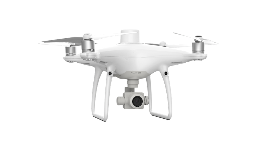
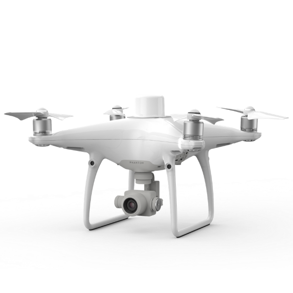
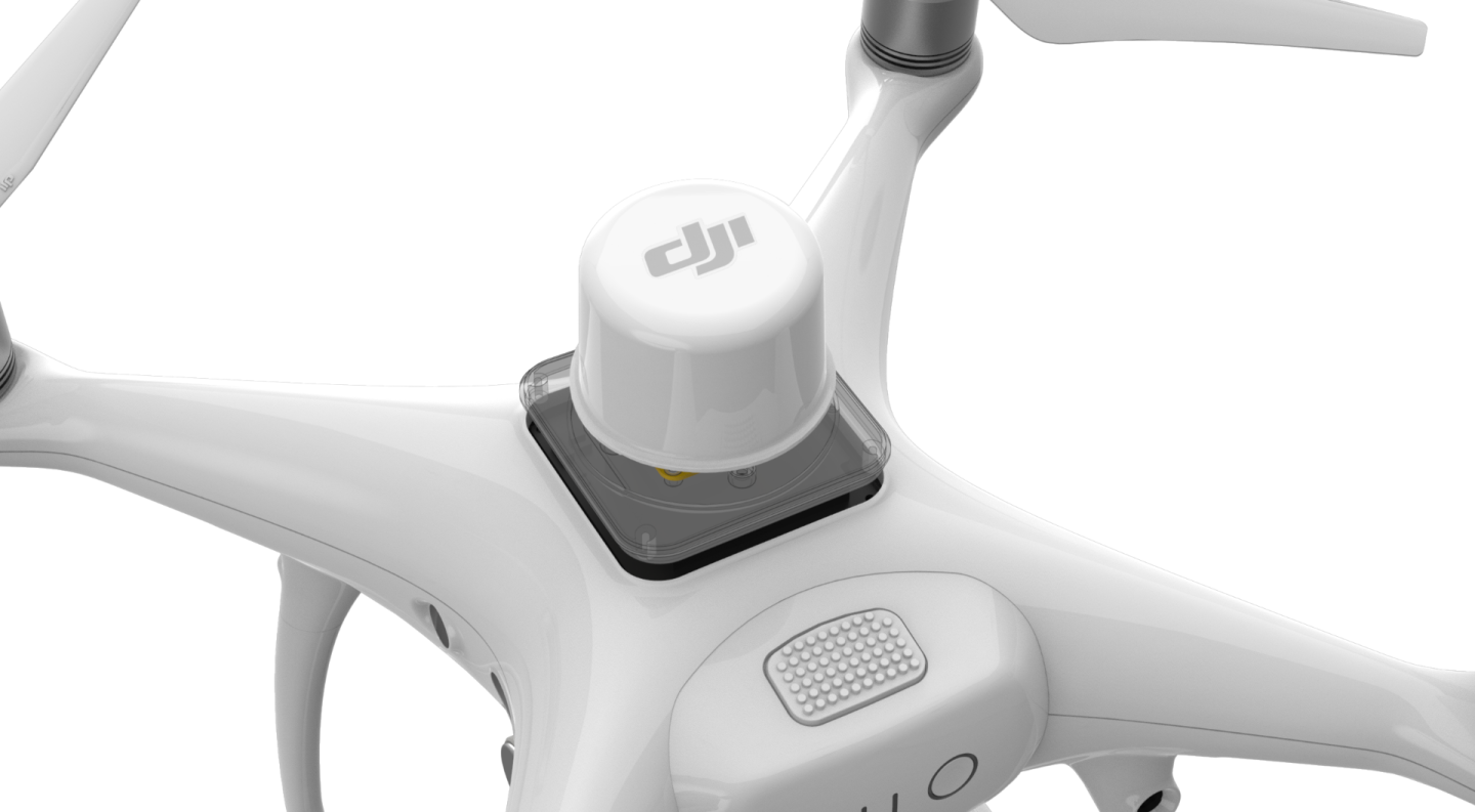
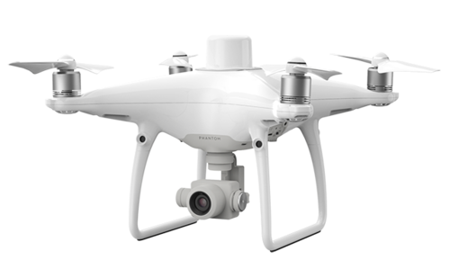
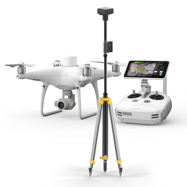
Read postThe Phantom 4 RTK has been the workhorse drone for thousands of surveyors across the country. Released in 2018, it has been extremely popular among the...
Read postDJI recently announced their new M350 drone platform, the successor to their current flagship M300. It has a number of minor quality of life...
Read postDJI recently released their new Inspire 3 drone, and we have had the chance to go through all of the information about their latest aircraft and camera...
Read postMore and more surveyors are using Lidar, which brings new capabilities and new challenges to drone surveying. One common questions is whether you can...
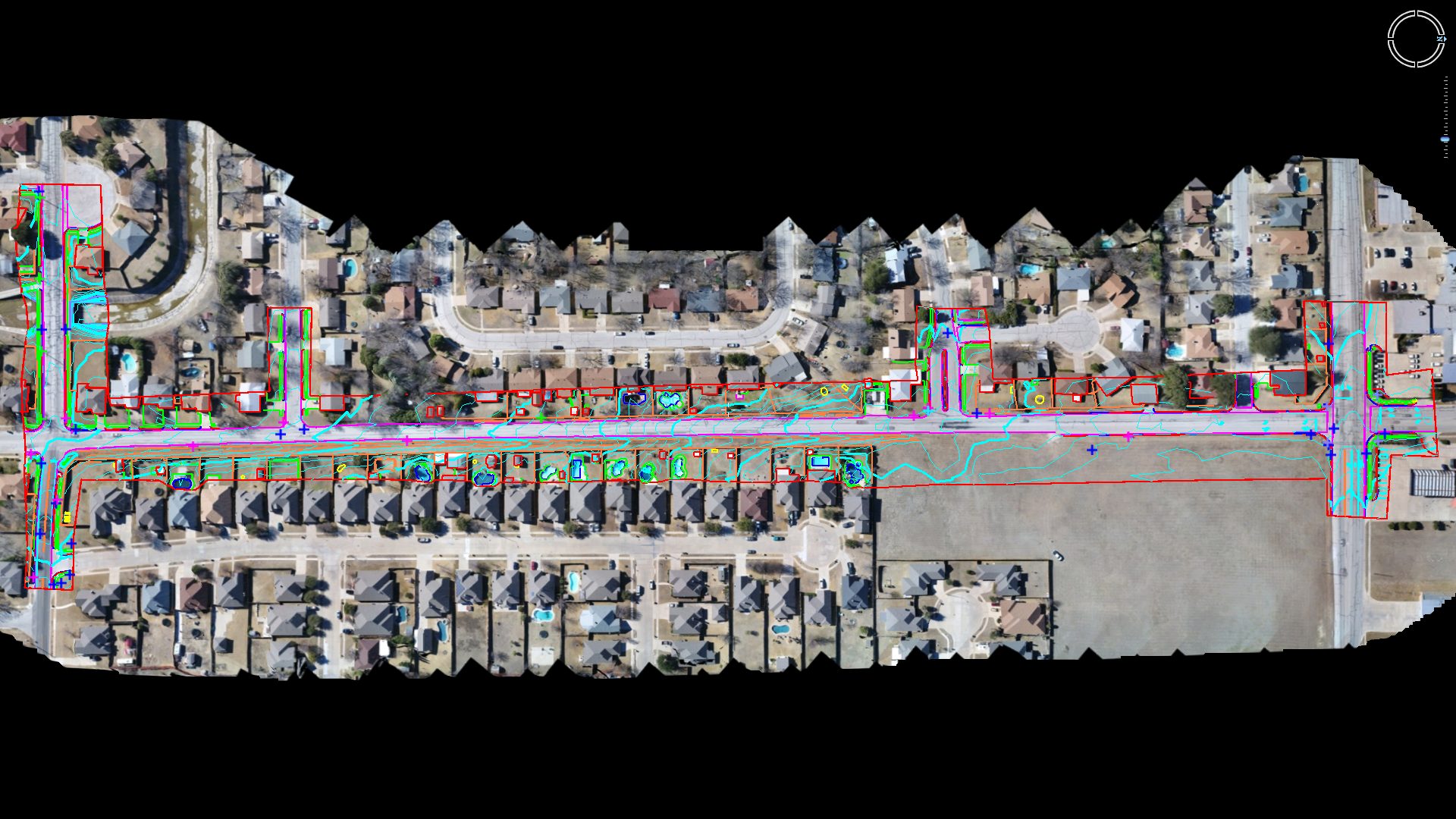
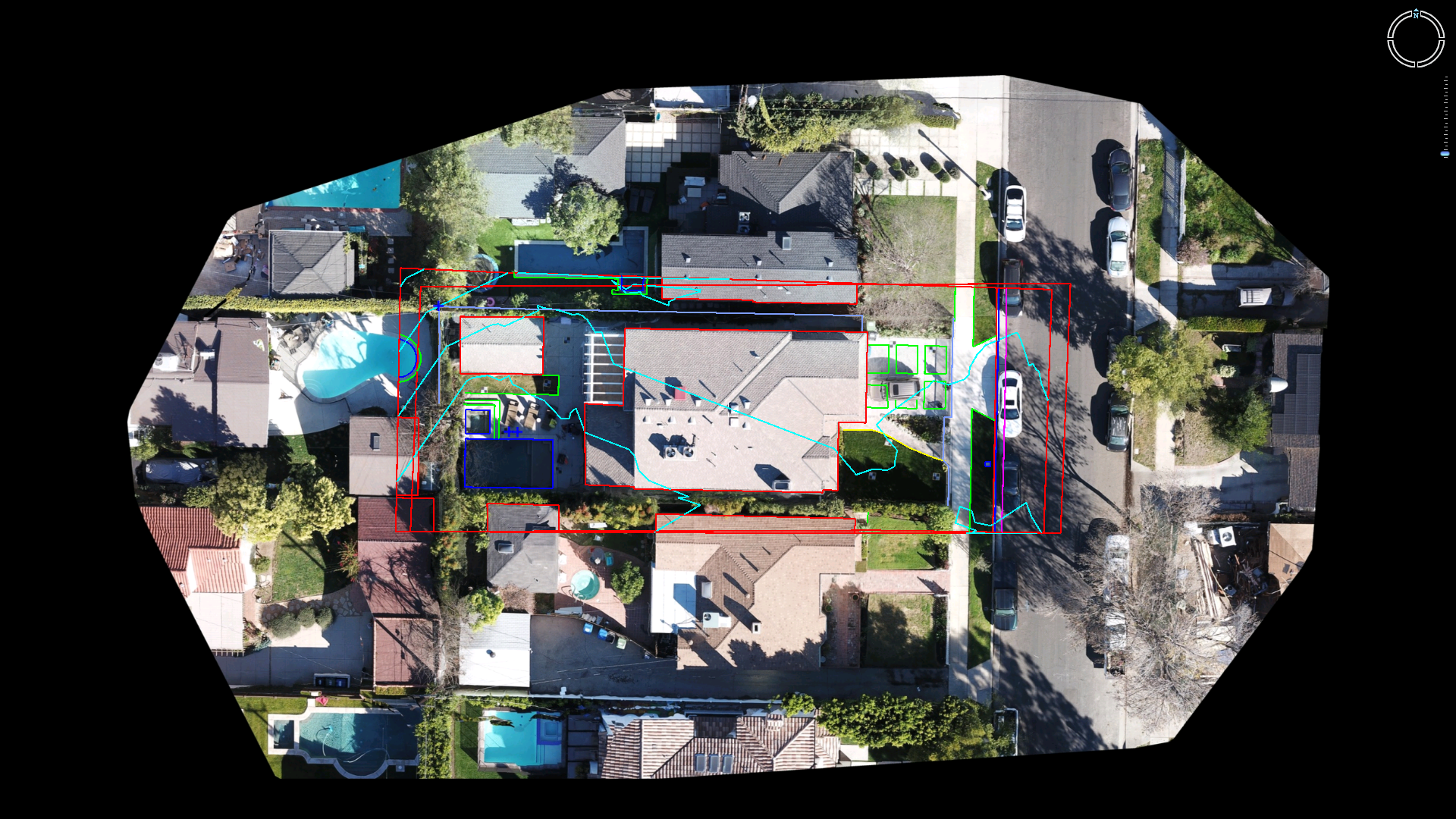
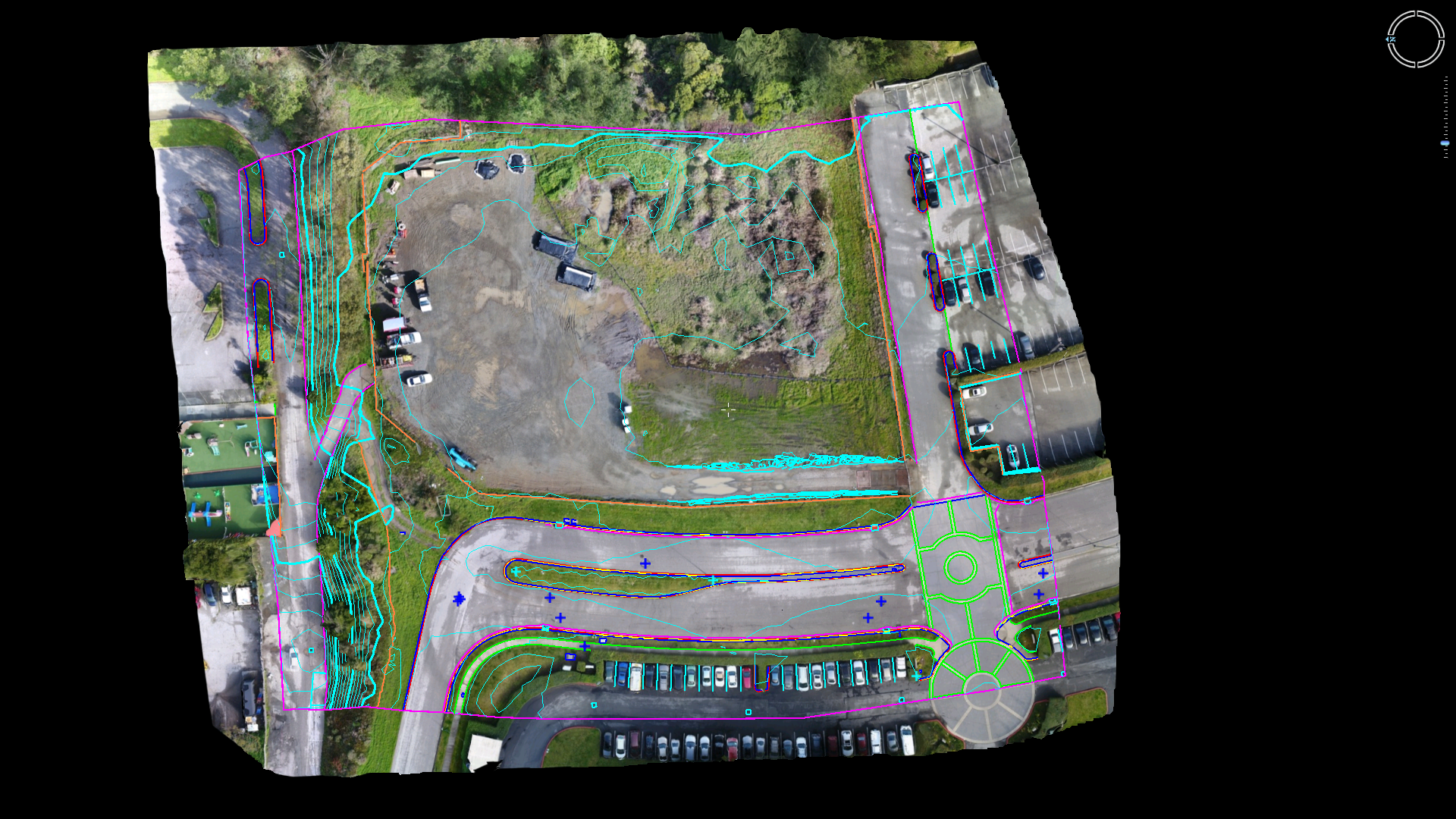
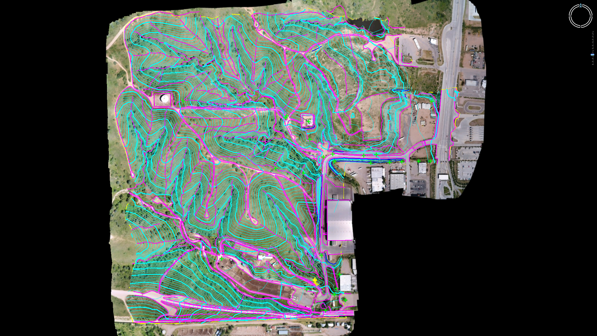
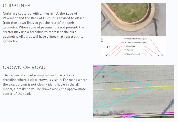
Read postThis month we are updating our CAD Standards and CAD templates as part of our ongoing process of improving the overall quality of our linework...
Read postThe Mavic 3 Enterprise is DJI’s latest hardware release that is capable of performing survey grade mapping. It promises an advanced suite of...
Read postDJI’s long-anticipated L1 sensor is finally here, and we’ve been doing dozens of test flights and spending hundreds of hours flying and analyzing data...
Read postDJI Changed How You Unlock a GEO ZoneWhat’s New with DJI Geofencing?
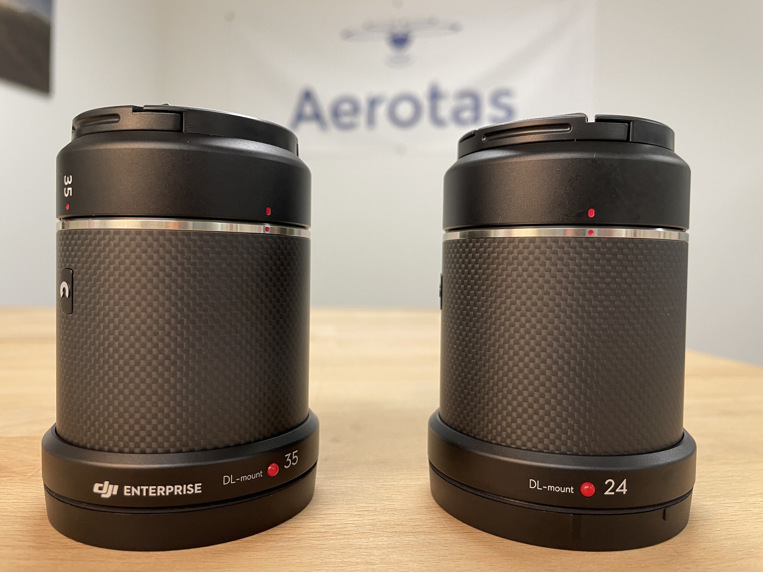
Read postDJI states that “The P1 supports 24mm, 35mm, and 50mm lenses with industry-specific DL mounts. Only use lenses engraved with the "DJI Enterprise" logo...
Read postThere are numerous ways to process GNSS data from the DJI M300 RTK and the Phantom 4 RTK. This article will discuss the five most common methods for...
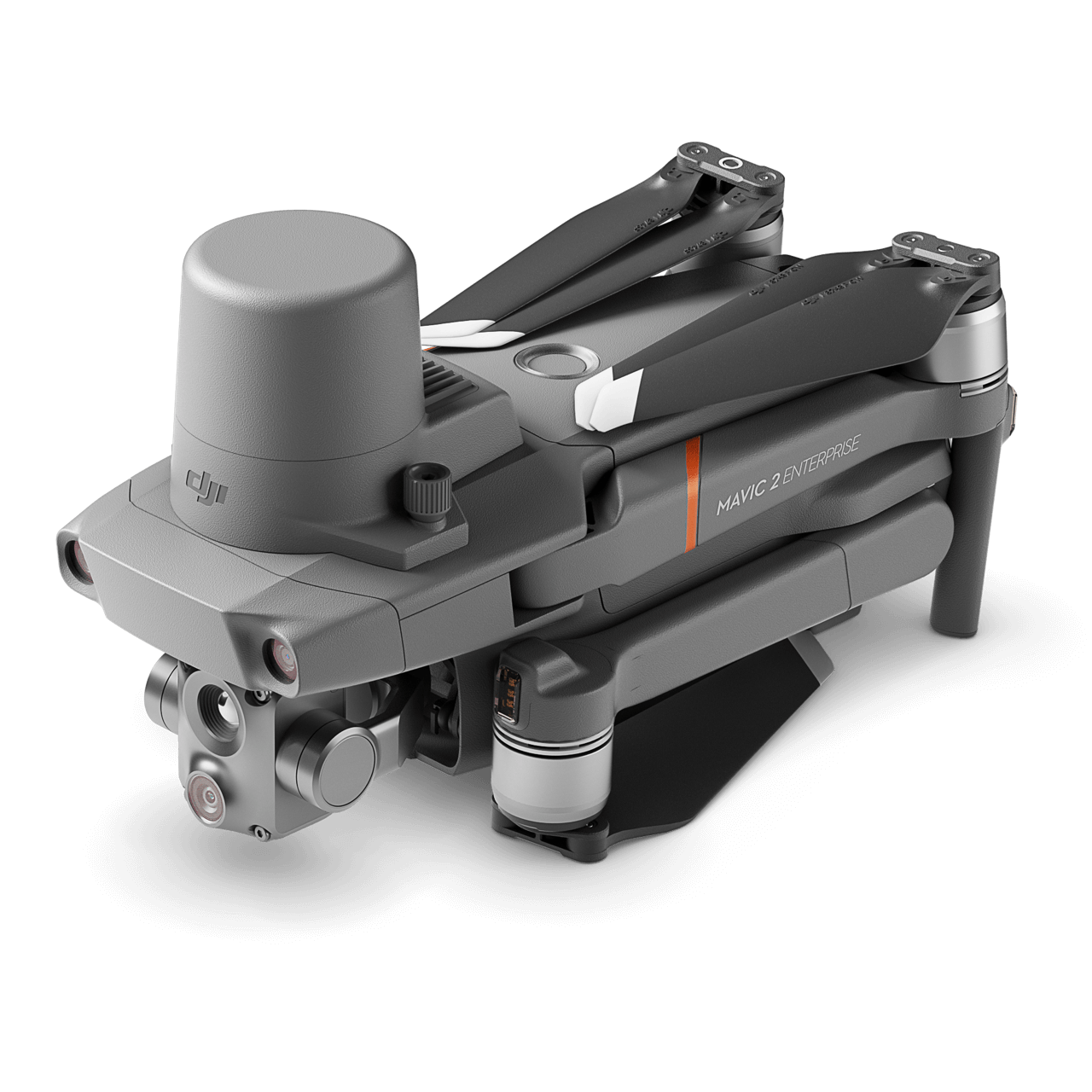
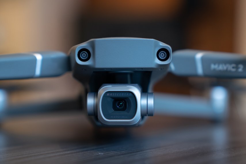
Read postIs the Mavic 2 Enterprise Advanced a good drone for Land Surveying?
Read postTips to get the most out of your drone data during the colder months.
Read postAt Aerotas our primary focus is processing the drone data that surveyors collect in the field. But, we also pride ourselves on being a trusted advisor...
Read postDJI announced two new payloads for the Matrice 300 RTK: Zenmuse P1 and the Zenmuse L1.
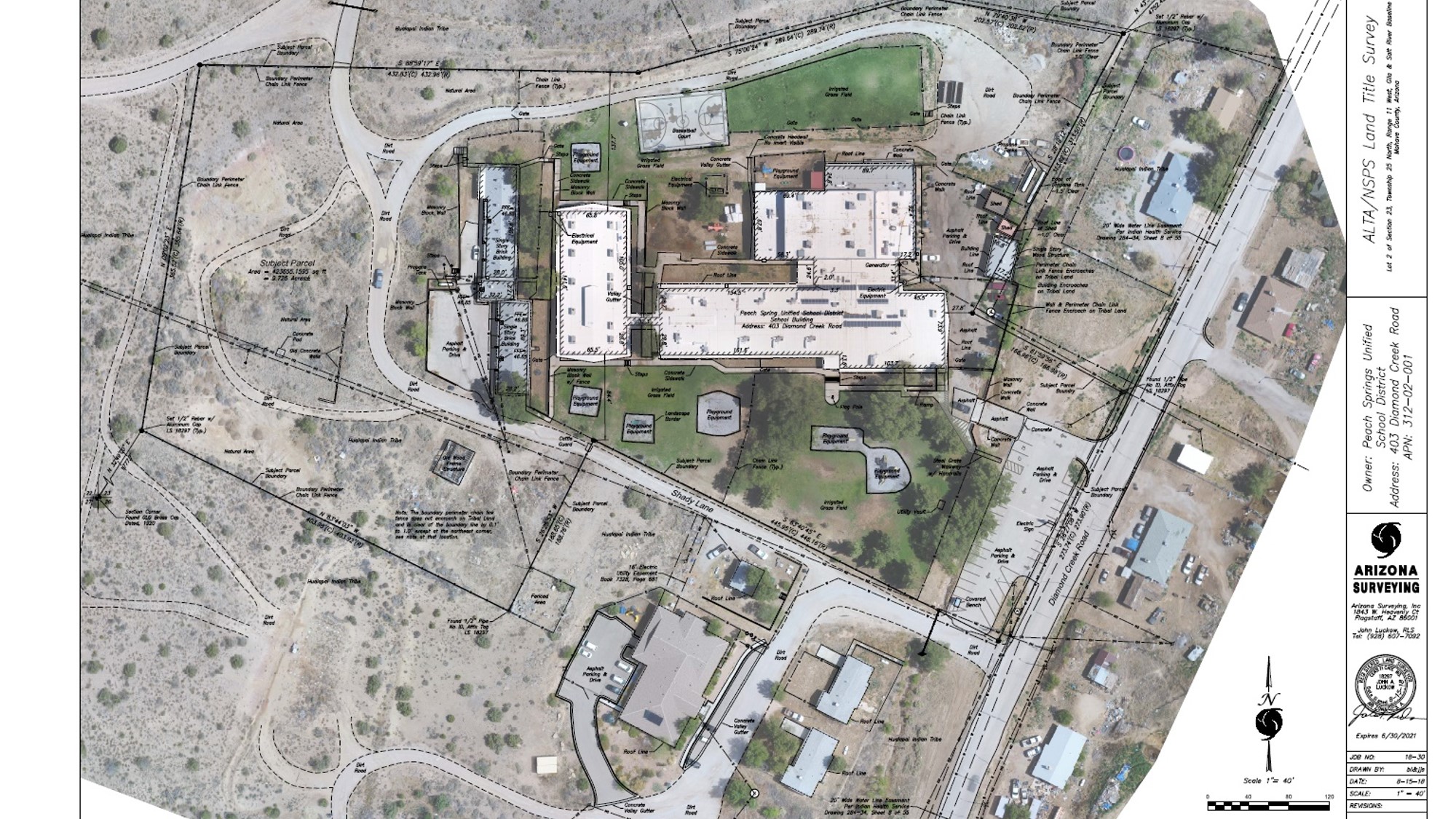
Read postAerotas is excited to announce a new product focused exclusively on the requirements for ALTA/NSPS Land Title Surveys.
Read postAerotas presented two different sessions at this year’s APLS-CLSA-NALS Virtual Conference. Download the presentations here.
Read postAerotas is proud to announce a new workflow that we have developed for processing large projects with airborne RTK/PPK.
Read postThe Aerotas Flight Operations team helps you get the most out of your drone surveying missions.
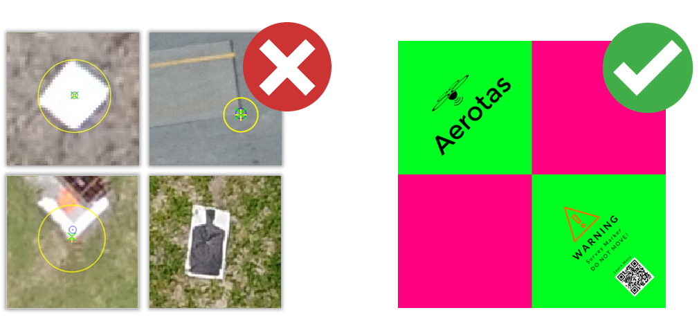
Read postPoorly Marked GCPs introduce error to your drone survey project.
Read postPhantom 4 RTK vs Phantom 4 ProShould you make the switch to the Phantom 4 RTK?
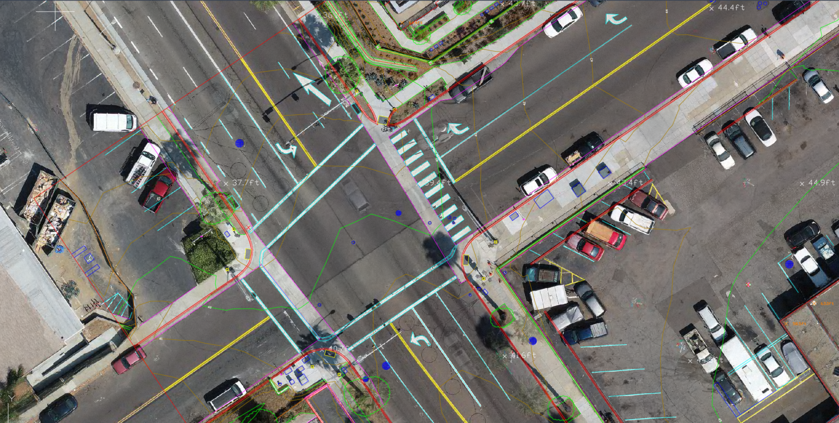
Read postIn this article, we will go into detail about what truly makes a project survey grade.
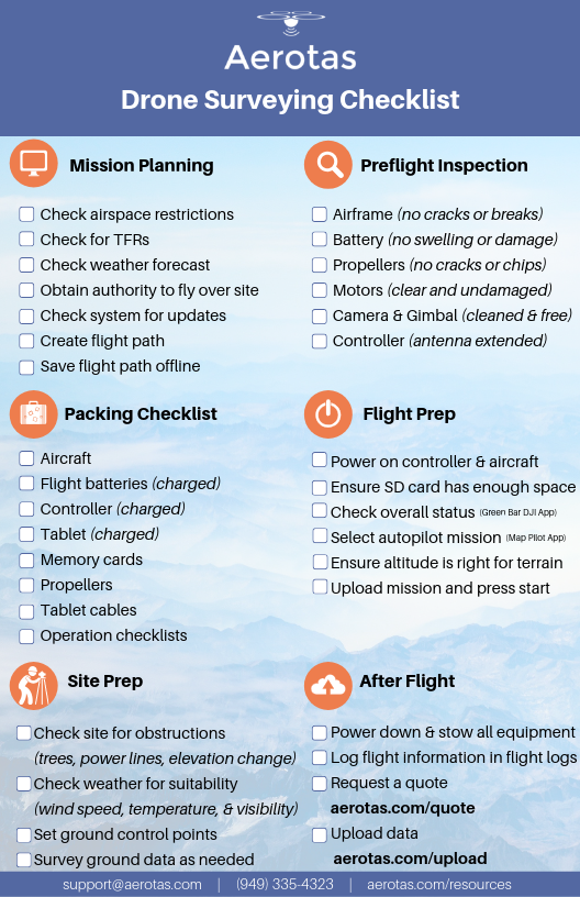
Read postIn order to maintain the reliability of our drone, we need to inspect and update our equipment on a regular basis. It is important to thoroughly run...
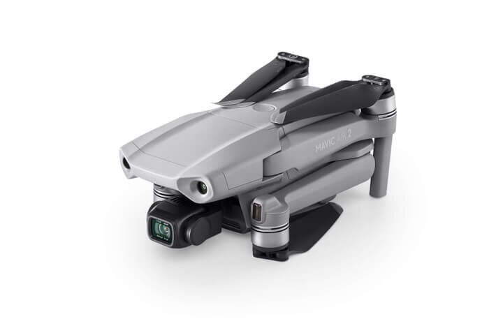
Read postIs the Mavic Air 2 a good drone for Land Surveying?
Read postImprove the image quality of your drone surveys, and get better accuracy.
Read postHow Aerotas Helped TD&H Engineering Survey More Land With Fewer People
Read postISPLS hosted a webinar on Fri, Apr 3, 2020, where Aerotas CEO, Logan Campbell, presented advanced data processing workflows for creating surveys with...
Read postAerotas is open for business as usual for any of your drone data processing needs.
Read postLogan Campbell, CEO of Aerotas, spoke at the UCLS annual conference in St. George, Utah at the Dixie Convention Center. This is the video of his...
Read postFlying in wintry conditions generally has little impact on the quality of the data, but there are a few things worth noting. Cold weather shortens...
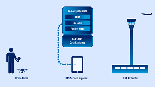
Read postThe FAA recently released its proposed rules for the “Remote Identification” of drones and UAS. This article details the impact on surveyors.
Read postDJI announced that all of their drones will have ADS-B In after January 1, 2020. This is confusing because starting January 1, 2020, all manned...
Read postGeoDataPoint - UAVs | Finding A Place for Drones in Surveying The steady rise of unmanned aerial vehicles still leaves surveyors and photogrammetrists...
Read postIf you are flying in controlled airspace you need to ensure that you have FAA authorization and that you have unlocked any DJI geofencing. These are...
Read postTerrain awareness, or terrain-following as some like to call it, eliminates the variance in above-ground flight height and thus eliminates the...
Read postThere are a number of common misconceptions about data collection and processing that lead surveyors to collect too much data. You can spend less time...
Read postLogan Campbell, Founder and CEO of Aerotas, spoke at the Pix4D User Conference 2019 in Denver, Colorado. Logan discussed measuring and certifying...
Read postRenew your FAA airspace authorizationsUpdate DJI Geozone DatabaseCheck the FAA’s website for news and updates
Read postAerotas provides human-in-the-loop data processing services to professional land surveyors and engineers throughout the United States. 800+...
Read postWorking in point clouds is difficult for three main reasons. This article will help you avoid these common pitfalls and provide a few tips for...
Read postDisposable HiVis Ground Control Points (GCPs): New hi-vis colorsNew matte finish100% bio-degradable
Read postAerotas Linework has been evolving quickly. Many of you have seen the incremental and iterative improvements, while others have requested a more...
Read postStarting today (May 23, 2019) more than 100 additional control towers and airports will be added to LAANC.The LAANC capability is increasing access for...
Read postAerotas is aware of a warning issued by the Department of Homeland Security in regards to the information security associated with chinese manufactured...
Read postDJI has a database that fences off areas where you may need authorization to fly and prevents their products from flying there altogether. This may...
Read postIn May, 2019, Logan Campbell, founder and CEO of Aerotas, spoke at the APLS conference on how drones can help with land surveying.
Read postSurvey conferences from all over the country tend to cluster in the winter months. So, Aerotas bundles up and heads out into the cold to share lessons...
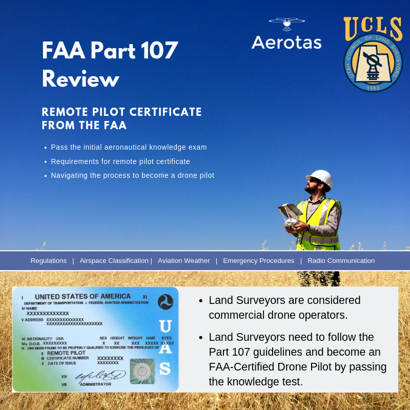
Read postAerotas has designed all new online training courses to get you over the FAA Part 107 hurdle, impart useful operational safety guidelines, and ensure...
Read postThe newest version of our checklist is smaller, laminated, and designed to always stay with your drone kit. The checklist will be used along side a...
Read postDJI just released a firmware update for the Mavic 2 Pro on Wednesday, April 17, 2019. You should update your firmware as soon as possible because this...
Read postIn order to maintain reliability in our UAS, we need to inspect and update our equipment on a regular basis. After a long winter, or prolonged bad...
Read postIn March, 2019, Logan Campbell, founder and CEO of Aerotas, spoke at the joint CLSA and NALS conference on how drones can help with land surveying.The...
Read postIn March, 2019, Logan Campbell, founder and CEO of Aerotas, spoke at the joint HLSA and HIGICC conference on how drones can help with land...
Read postGood news for surveyors using DJI products! DJI drones will NOT be affected by the 2019 GPS Week Number rollover event.
Read postTrey Swann from Aerotas presented at The Oklahoma Society of Land Surveyors (OSLS) Convention on Friday, March 1st, 2019. Trey covered the complete...
Read postEarlier this year, Logan Campbell, founder and CEO of Aerotas, spoke at the Land Surveyors Association of Washington (LSAW) annual conference on how to...
Read postOn February 22, 2019, Aerotas Founder and CEO, Logan Campbell, spoke at the Utah Council of Land Surveyors Summit (UCLS 2019). The presentation is...
Read postOn February 21, 2019, Aerotas CEO Logan Campbell presented a full-day workshop on how to prepare for the FAA Part 107 Unmanned Aircraft General exam....
Read postWhen you use Aerotas to process your drone data, you immediately get access to our Flight Ops team. The sole responsibility of Flight Ops is to guide...
Read postWe have processed thousands of drone survey projects for our customers, and we have learned the hard way why photogrammetry is a Ph.D. level science....
Read postOn January 28, 2019, Aerotas CEO Logan Campbell presented a workshop on how to achieve accuracy and efficiency using drone photogrammetry. Below is the...
Read postAerotas has been successfully processing data collected with the Phantom 4 RTK since October of 2018. When working with Aerotas, this is the...
Read postThe Indiana Society of Professional Land Surveyors hosted Aerotas Co-Founder Daniel Katz for a guest webinar. In the webinar, Daniel covers a few key...
Read postAirborne RTK for land surveyors has been a technology with an enormous amount of promise for quite a few years now, but was being held back by...
Read postAerotas regularly provides thought leadership for Commercial UAV News from the perspective of the land survey industry. In this post, Executive Editor...
Read postWhen the American Society of Photogrammetry and Remote Sensing (ASPRS) launched their Certified Mapping Scientist-UAS certification, Aerotas Founder...
Read postWith Aerotas' position as the preeminent provider of drone solutions for land surveyors, we constantly field questions from surveyors about various...
Read postIn the June issue of Point of Beginning magazine, Aerotas co-founders were asked to weigh in on their analysis of the different types of drone...
Read postWith Aerotas' position as the preeminent provider of drone solutions for land surveyors, we constantly field questions from surveyors about various...
Read postLast week, the California Land Surveyors Association invited Aerotas co-founder Daniel Katz to present a webinar to their members on best practices in...
Read postPoint of Beginning magazine asked Aerotas co-founders Daniel Katz and Logan Campbell to analyze the various components of drone technology that go into...
Read postIn a guest article on Commercial UAV News, Aerotas co-founder Daniel Katz discusses some of the misconceptions Aerotas sees surveyors frequently bring...
Read postThe FAA has officially started rolling out the system that allows instantaneous airspace authorizations. LAANC is the FAA’s new system for permitting...
Read postIn the most recent issue of Point of Beginning magazine, Aerotas highlight the work of one of our most prolific clients: WM Surveys of Ventura, California.
Read postIn the most recent issue of Point of Beginning magazine, Aerotas co-founders Logan Campbell and Daniel Katz lay out the basic expectations for a...
Read postIn their report “8 Commercial Drone Predictions for 2018,” Commercial UAV News interviewed Aerotas Co-Founder Daniel Katz. Katz weighed in on key...
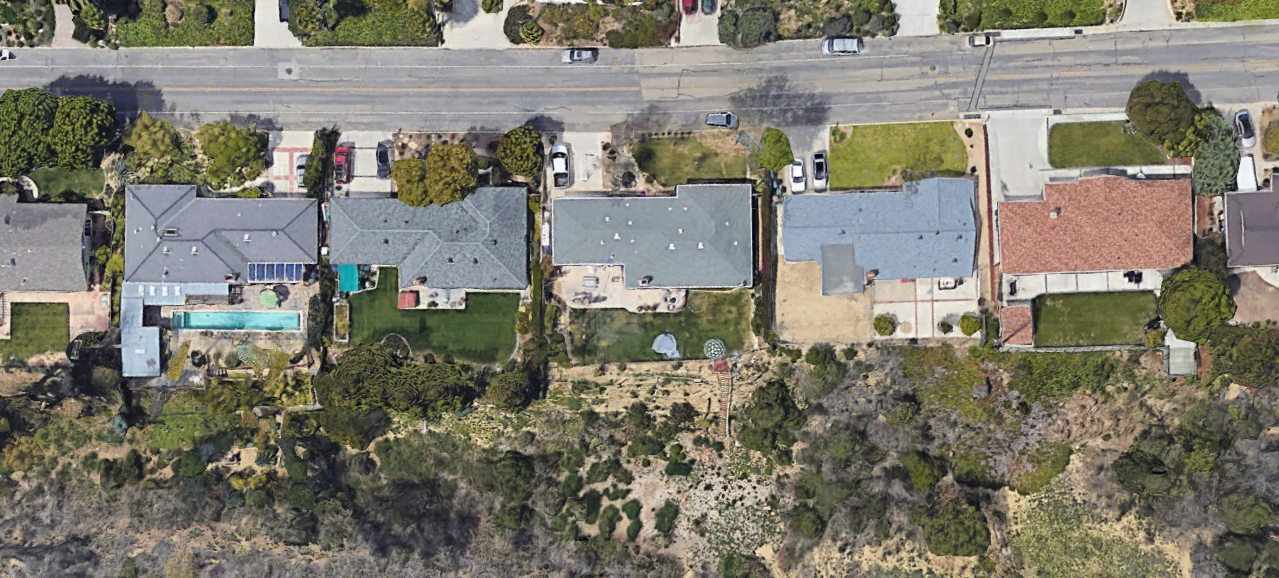
Read postRebuilding homes after a natural disaster like a wildfire can be tough. And while it’s hardest on the homeowner, it can be a difficult process for...
Read postThe recent California wildfires destroyed thousands of homes, leaving many people struggling to get back on their feet. Rebuilding after such...
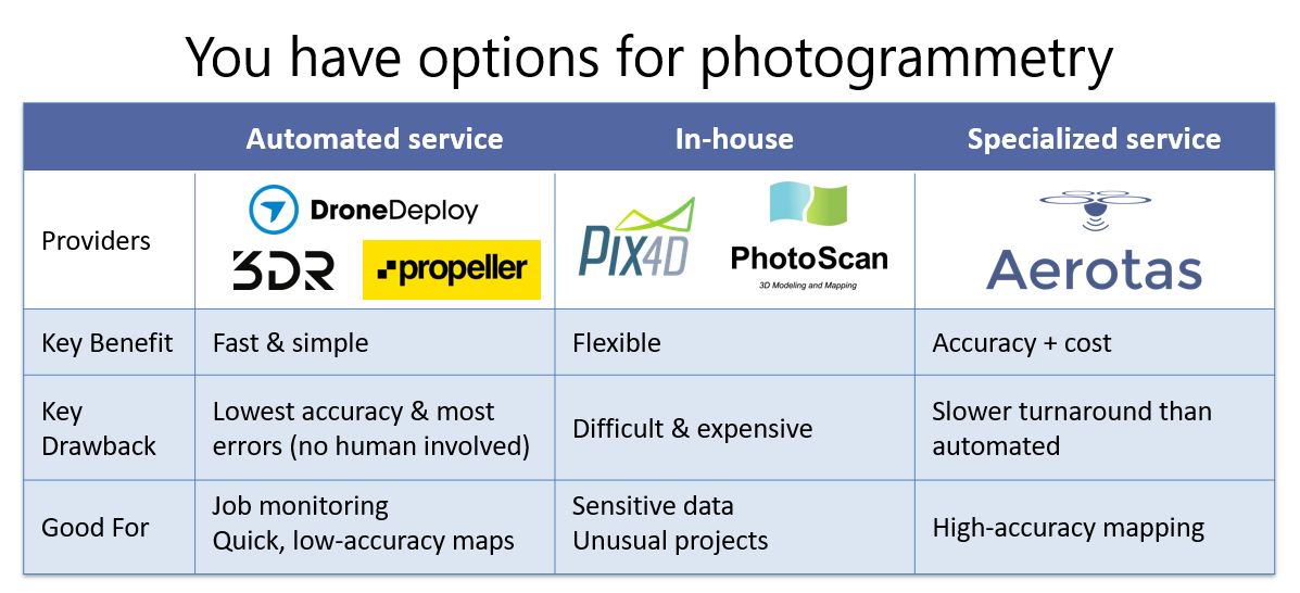
Read postIn an interview with Commercial UAV News, Aerotas founder Logan Campbell helps readers determine which of the many options for processing drone data is...
Read postOn December 1, 2017, Aerotas co-founder Daniel Katz presented a webinar for the New York State Association of Professional Land Surveyors. In the...
Read postIn the December issue of Point of Beginning, Aerotas co-founders Logan Campbell and Daniel Katz explore a key issue faced by the land survey community:...
Read postThe hype is finally dying down in the world of drones. Thank goodness. Throughout 2015 and 2016, many people dreamed and opined about how drones could...
Read postWith the popularity of of UAVs in commercial applications increasing, more and more companies are regularly coming across the question of what is the...
Read postIn a recent interview with Commercial UAV News, Aerotas Co-Founder Daniel Katz discusses the crucial stakes for the Aerotas Mapping System -- and the...
Read postAs experts on the drone industry, we often receive requests to weigh in on new ideas in the industry. While a healthy climate of innovation still...
Read postWho controls the airspace above your home? This question is beginning to generate a lot of attention lately. Under the current law, there is no clearly...
Read postAnyone that has worked in large public areas before knows that there is always a risk of theft, vandalism, or loss of equipment. It is simply an...
Read postIn the August issue of Point of Beginning magazine, we address one of the most challenging misconceptions among surveyors starting drone programs: the...
Read postAerotas client John Luckow, President at Arizona Surveying, wrote an excellent commentary on a critical and under-discussed issue: as more people are...
Read postMany surveyors purchase a drone and start using it without ever considering the importance of having clearly-defined operations -- goals, procedures...
Read postThere is often a lot of confusion about what it means to be a professional drone pilot. In this post, we explore the 4 critical steps it takes to...
Read postIn the conversations we have had with hundreds of land surveyors, civil engineers, and other mapping professionals about starting a drone program, we...
Read postIn their recent free report "How are Mining & Aggregates Professionals Using Drones in 2017?" Aerotas co-founders Logan Campbell and Daniel Katz lend...
Read postWith dozens of land surveyors, civil engineers, and other mapping professionals using our drone mapping system on a daily basis, we have a great...
Read postIf we seem to be repeating ourselves, it's because this is one of the most important things we have learned: the companies that succeed with drone...
Read postOn the heels of the implementation of the FAA's new commercial drone laws, called Part 107, the team at California Surveyor Magazine once again asked...
Read postAerotas was honored when Point of Beginning magazine asked us to follow up our article in the September issue with another in October. In October's...
Read postDaniel@aerotas.comThis third in our series of posts expanding on our article in Cal Surveyor covers how the deliverables a mapping drone produces...
Read postThe co-founders of Aerotas were featured as Guest Columnists in this month’s Point of Beginning magazine. The focus of the article is on the critical...
Read postLogan@Aerotas.comIncluded in the FAA's new drone laws is the ability to operate a drone from within a moving vehicle. This dramatically expands the...
Read postLogan@Aerotas.comToday, the FAA's landmark commercial drone rules went into effect. That also means that today was the first day to take the new...
Read postDaniel@aerotas.comThe second in a series of posts expanding on our article in Cal Surveyor. As we discussed in the article, mapping drones can produce...
Read postThe Aerotas Map Package is an all-inclusive package of everything an organization needs to start mapping by drone, and it leverages many lessons that...
Read postLogan@Aerotas.comLast week, I spent a day in the field getting a client trained on their new UAV equipment. Naturally, I thought this would be a great...
Read postDaniel@aerotas.comIn our article in California Surveyor Magazine, “What you need to know to determine if UAVs are right for your survey business,” we...
Read postDaniel@aerotas.comWhen Part 107 goes into effect in August, it will open huge opportunities for businesses across industries to use drones in daily...
Read postLogan@aerotas.comThe FAA recently released its new drone regulations, known as Part 107. Included is a provision that allows the FAA to grant waivers...
Read postThis morning the FAA published the first official set of rules governing commercial drone use: Part 107. When these new rules go into effect in August,...
Read postDaniel@Aerotas.comOn June 14, Aerotas cofounders Daniel Katz and Logan Campbell participated in the Drone Information Day at the State Capitol. The...
Read postWe recently saw a Drone being operated commercially at the BottleRock Music Festival in Napa, CA. The footage is great, but there are some serious...
Read postDaniel@Aerotas.comWhile the FAA has missed a number of deadlines for rolling out rules governing commercial UAV use in the United States, it does...
Read postLogan@Aerotas.comRegulation is a key topic to consider when planning any commercial drone operation. There is a lot of complicated, controversial, and...
Read postLogan@Aerotas.comThere are several ways that a drone can be piloted, but determining which approach is right for you requires understanding the...
Read postDaniel@Aerotas.comA key consideration for any business looking into commercial UAV operations is getting the right insurance. But what drives risk...
Read postLogan@Aerotas.comIs it legal to fly drones for commercial purposes? The real world answer is more complicated than yes or no. We explore the real...
Read postLogan@Aerotas.comThe FAA has released their final rule for drone registration, but most people overlook the impact that this will have on businesses....
Read postLogan@Aerotas.comEarly this week, the FAA published the recommendations of their task force on drone registration. Though there exist some significant...
Read postLogan@Aerotas.comThe DoT and FAA have asked for comments on how to register small UAS. Registration could seriously damage the industry, and the hobby....
Read postIn a press conference earlier today, the US Department of Transportation announced its plan to require the registration of drones operating in the...
Read postWe helped Harvard host a drone event. But a lot goes into this behind the scenes. Drone insurance, safety policies, and custom netting all played a...
Read postWe at Aerotas have spent the past 3 days at the UAS Mapping conference in Reno, Nevada. In addition to a deluge of information about surveying,...
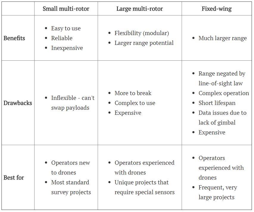
Read postDrones have huge potential for businesses. But what is the right drone for you?
Read postLogan Campbell - Logan@Aerotas.com
Read postAccording to Bloomberg News, the FAA has begun investigating at least three NFL teams that have started using drones to film their practices. So far,...
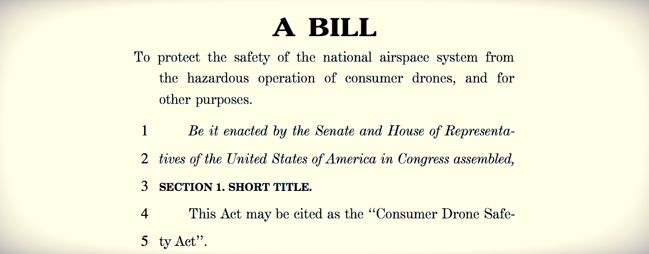
Read postRecently, senator Dianne Feinstein introduced the Consumer Drone Safety Act, a proposed law meant to prevent potentially deadly collisions between...
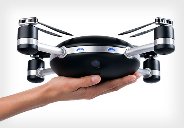
Read postThere has been a huge amount of hype in recent days about the Lily Camera Drone, a product that flies itself while taking pictures or videos of...
Read postWelcome to Aerotas, the first small UAV focused consulting firm. Our only business is to help other companies use small UAVs in a way that is safe,...
Read post![[Webinar] The State of Drone Surveying: A Strategic Briefing for 2026](/assets/img/blog/webinar-the-state-of-drone-surveying-a-strategic-briefing-for-2026/hero.png)
![[Webinar] DJI Zenmuse L3 for Surveyors](/assets/img/blog/webinar-dji-zenmuse-l3-for-surveyors/hero.png)
![[Webinar] Mastering Aerial Lidar in Land Surveying Series: Session 3](/assets/img/blog/fallback/hero.jpg)
![[Webinar] Drone Survey Hardware: 2025 & Beyond](/assets/img/blog/webinar-drone-survey-hardware-2025-amp-beyond/hero.jpg)